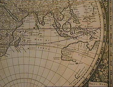
Doncker's early eighteenth century chart illustrating the then inbility of navigators to establish longitude - Tasmania is too far west.